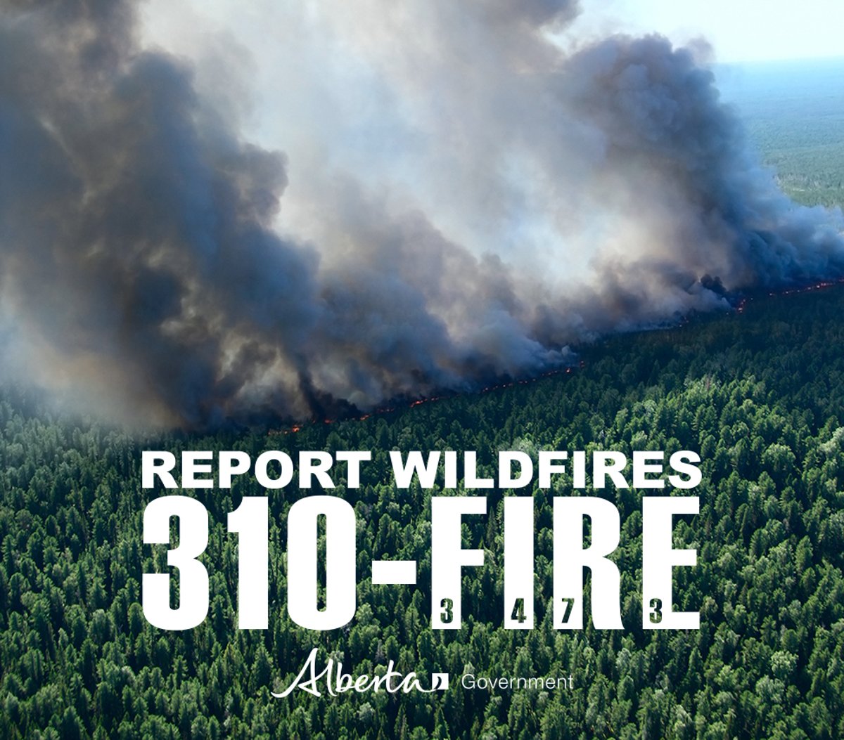
The wildfire danger is very high in the High Level Forest Area. The fire ban and off-highway vehicle restriction remain in effect. A provincial state of emergency has been declared. Albertans who require assistance can call 310-4455 for wildfire related information. To report a wildfire please call 310-FIRE(3473).
FIRE BAN AND OHV RESTRICTION IN EFFECT
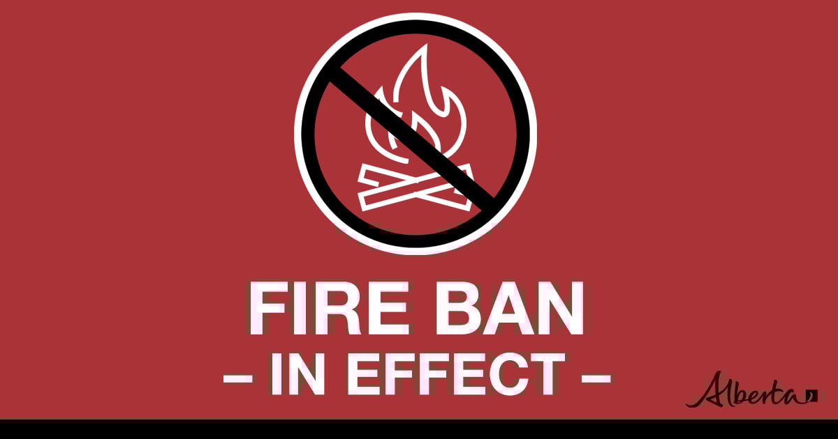
A fire ban and OHV restriction is in effect within the High Level Forest Area due to extreme fire danger. The fire ban and OHV restriction will remain in effect until conditions improve.
Under this fire ban:
•All existing Fire Permits are suspended (or cancelled)
•No new Fire Permits will be issued
Prohibited:
•All outdoor wood fires are banned, including wood campfires on public lands, wood campfires on private land and provincial campgrounds
•Backyard firepits
•BBQ charcoal briquettes
•The use of fireworks and exploding targets
•The recreational use of off-highway vehicles (OHV) on public lands, including designated OHV trails
Allowed:
•Propane/natural gas-powered appliances
•Open flame oil devices (e.g., turkey deep fryers, tiki torches)
•Indoor wood fires contained within a device with a chimney and spark arrestor
•All appliances must be CSA approved and used per manufacturer’s standards
•Indigenous people when using an OHV for traditional purposes. Traditional purposes are hunting, fishing, and trapping – including the use of an OHV to travel to the location(s) for these purposes.
•Essential industry-related activities requiring the use of OHVs.
•Off-highway vehicle use is still permitted on private lands.
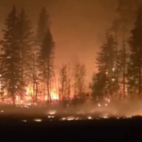
ACTIVE WILDFIRE AREA | SAFETY MESSAGE
Stay away from active wildfire areas | For your safety and to ensure firefighters can do their job safely, please stay away from active wildfire areas. Your cooperation is essential.
Danger trees | Be extra cautious near burnt areas and avoid forested areas that have been recently affected by wildfire. Hazards remain from falling trees or branches, especially if windy, deep ash pits and burning peat.
Reporting wildfires | Please do not report smoke or flame from within an active wildfire area. Firefighters are diverted from essential tasks to respond to fires reported by the public. You may see smoke or flame within the existing boundary of a wildfire, this is normal.
Smoke | Lingering smoke may still be visible in some areas and in affected communities. Smoke inversions can trap air near the ground causing dangerous driving conditions and poor air quality. Please use extra caution when driving in smoky conditions, and take necessary precautions if you have smoke-related health concerns.
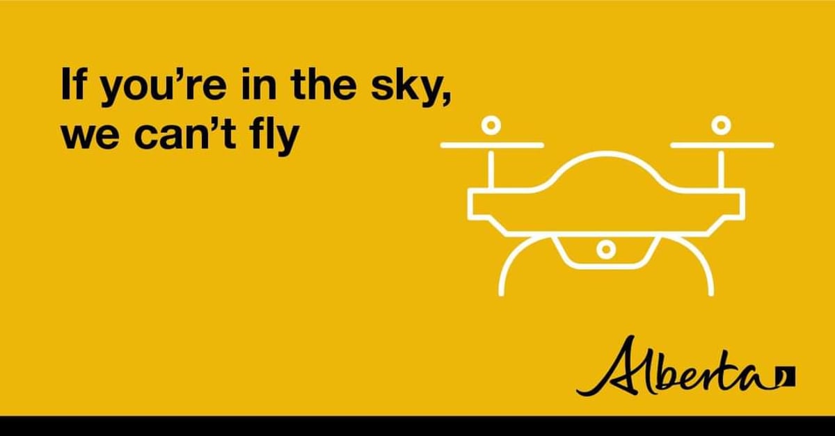
Drones | The use of recreational drones over wildfires in Alberta is dangerous, illegal and could result in a fine of up to $15,000* for putting aircraft and people at risk. Please give Alberta firefighters the space they need to do their jobs safely. *Transport Canada
Ignition operations are a tool firefighters use to contain areas of the fire perimeter. Please stay away from an active wildfire for your safety.
HIGH LEVEL FOREST AREA | WILDFIRE SITUATION | JUNE 2, 2023 AS OF 1:00 PM
There are five wildfires in the High Level Forest Area. Of these fires, two are classified as out of control (OC) and three are under control (UC). To see a map of the wildfires in the High Level Forest Area and across the province please click here.
THE LONG LAKE FIRE | HWF036 | JUNE 2, 2023 AS OF 1:00 PM
This fire is located in the vicinity of the Town of Rainbow Lake. This wildfire is classified as out of control (OC) with a last recorded size of 135,483 hectares.
The fire is currently 137,121 hectares in size and continues to remain active south of the Cenovus plant and southwest along Bivouac Road. Firefighters saw increased fire activity yesterday, south of the gas plant towards the powerline. Direct attack using a helicopter for bucketing and USA Hot Shot Crews were sent to the area. Large airtankers were also used to drop retardant to provide extra protection. Increased smoke and activity across the whole fireground today.
The fire is also active west of the Town of Rainbow Lake moving towards the British Columbia border. Heavy equipment such as dozers will be working today on containment of the southern edge of this fire.
The northeast guard protecting the community of Chateh continues to hold with no active fire along this edge. In addition,ATCO has restored power to the community of Rainbow Lake and Chateh.
Please be aware that there is still active fire burning in the area. Crews will continue to use hand ignition to tidy up edges of the fire as conditions allow. Residents are reminded not to enter the fire area due to large number of firefighters, and equipment working. Burnt trees continue to fall which are dangerous.
Incident Management Teams from Canada, America and Australia and a large number of helicopters are currently working at the Incident Command Post located at the Town of Rainbow Lake airport to support this fire. Please keep out of this area to allow firefighters to continue to do their job.
There are currently 209 personnel supporting the Long Lake Fire. Including wildland and structural firefighters, incident management staff and heavy equipment operators. There are also 8 helicopters, 15 dozers and 2 excavators dedicated to this fire.
Evacuation Information and Alerts
Re-entry to the Town of Rainbow Lake will commence at 9am on Friday June 2, 2023. For further information on the re-entry plan, cleaning your refrigerator/freezer, Insurance, cleaning your home, discarding food, mental health support and more, please go to www.rainbowlake.ca.
The community of Chateh remains under an evacuation. Please visit the Dene Tha Facebook page for updates.
Please stay informed by downloading the Alberta Emergency Alert mobile app or by visiting their website.
Weather Forecast | Long Lake Fire
Today the forecast is as follows, a temperature of 24 degrees, a relative humidity of 20 percent with west to southeast winds 15 km/h gusting to 30 km/h.
THE PASKWA FIRE | HWF030 | JUNE 2, 2023 AS OF 1:00 PM
The Paskwa fire is located in the community of Fox Lake and was detected on May 2, 2023. This fire is classified as Out of Control (OC) and the last recorded size is 88,094 hectares.
Winds were light yesterday, and fire behaviour was moderate. Work on meeting priorities continues including full extinguishment of fire in Fox Lake, protecting Garden River, and working toward securing the fire perimeter to prevent significant fire spread. Weather conditions remain hot and dry but there will be a shift to east winds today.
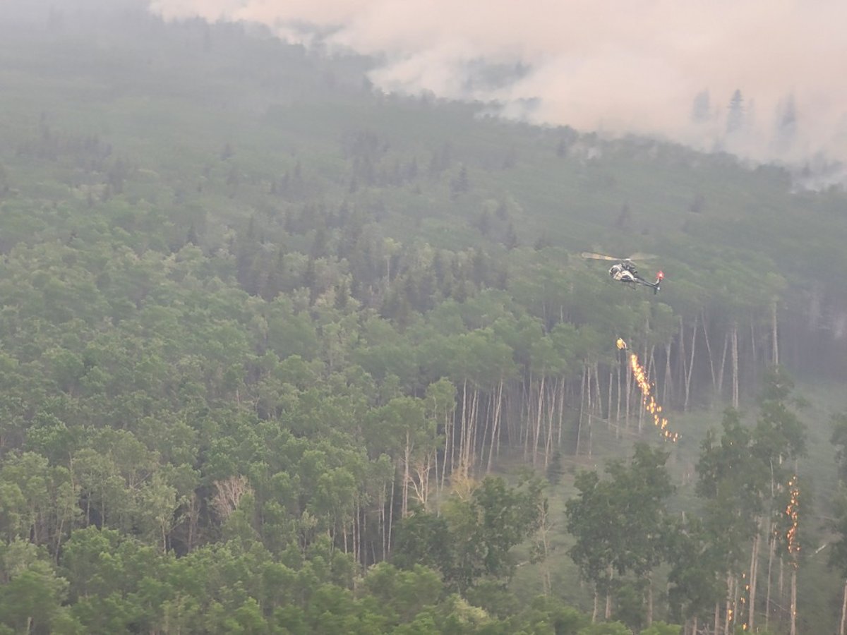
One of the top priorities is to protect the community of Garden River. Planned ignition operations completed between May 17 – 20 and on May 30, have created a fireguard between the community and the northeast perimeter of the Paskwa Fire. Crews continue to secure the fireguard with helicopters bucketing and may conduct some targeted ignition work in the coming days to remove any remaining forest fuels along the line. Crews and helicopters bucketing continue to work along the entire north-northeast perimeter to remove fuels and extinguish hot spots, keeping the fire south of the Peace River.
Installation of the high-volume water system, water lines, and sprinkler systems on structures within the community of Garden River is complete. These are proactive measures to ensure the community is prepared should the fire move closer to Garden River. Structural firefighters will maintain readiness in the community.
Work continues in Fox Lake to extinguish 76m (250 ft) perimeters around all structures and remove danger trees. With continued warm and dry conditions, hot spots are around the community are getting more active. Plans are being made for heavy equipment support to secure larger fire areas.
Crews continue work along the southern perimeter, extending the fire guard in the southwest by extinguishing an area 30m (100 ft) wide along the line to prevent fire spread. To the east, beyond the fire guard, ground crews are extinguishing hot spots along the southern perimeter with support from helicopters bucketing.
There are currently 202 personnel supporting the Paskwa Fire response including wildland and structural firefighters, incident management staff, heavy equipment operators, and Paskwa Fire Base support staff, as well as 12 helicopters dedicated to the Paskwa fire. Three additional heavy helicopters have been supporting fire operations over the last few days.
Little Red River Cree Nation has an evacuation order in place for the community of Fox Lake. The community of Garden River remains on an evacuation alert. For information regarding the evacuation, please stay informed by visiting the Little Red River Cree Nation’s Facebook page.
Weather Forecast | Paskwa Fire
Today the forecast is as follows, a high of 21 degrees, a relative humidity of 20 percent, with west winds 15 – 20 km/h.
Wood Buffalo National Park Fire Update| Davidson Complex
Davidson Complex consists of four fires in the Davidson Lake area of Wood Buffalo National Park. The fire is approximately 30km east of the community of Garden River. The fires do not currently pose a risk to the community.
Some growth was seen on these fires yesterday, mostly on the eastern side. On Monday evening and Tuesday, fire personnel put structure protection on cabins near the fire complex. Smoke and reduced visibility has made flying difficult. When possible, fire personnel will return to this area to maintain the sprinkler systems. Fire specialists are starting work on assessing containment options on this complex.
For more information regarding fires burning within the Wood Buffalo National Park, please click here.
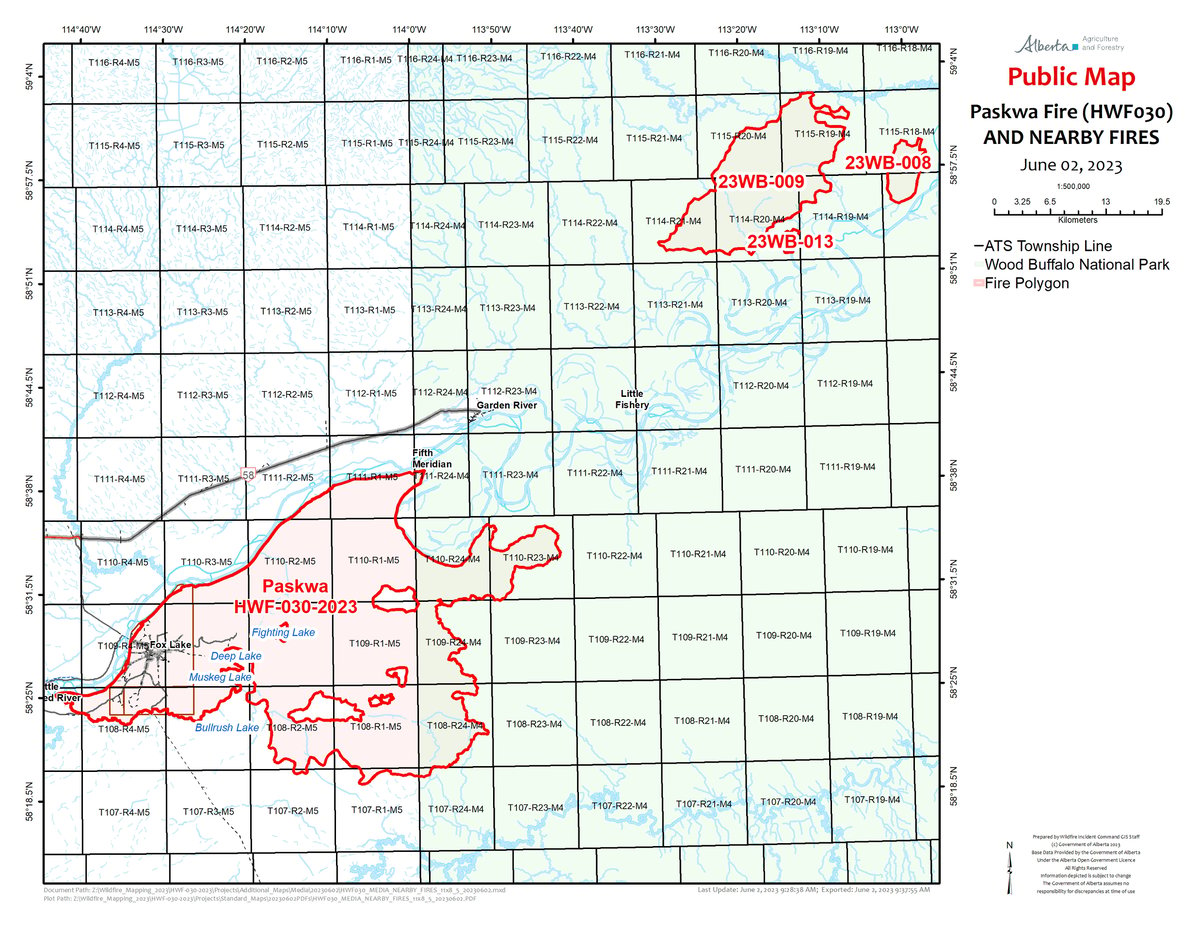
Map of the Paskwa fire and the fires in the Wood Buffalo National Park. Fire 23WB-009 is approximately 25 km northeast of the community of Garden River. June2, 2023.
WILDFIRE SMOKE ISSUES
Smoke from wildfires may hang low to the ground at night and into the early morning due to temperature inversions. A temperature inversion is when warm air “caps” cooler air, causing smoke to be trapped in valley bottoms at night and into the early morning. The trapped smoke generally begins to lift after the sun rises and heats the earth’s surface. Inversions can be very dangerous for road conditions and surrounding communities. Visibility can be limited.
If you see smoke that is causing safety concerns to road conditions, please report to Alberta 511. Individuals experiencing smoke related health issues can contact Alberta Health. To see a map showing the smoke forecast please click here.
VOULUNTEER INFORMATION
Volunteers, equipment owners/operators or firefighters looking to assist with these wildfires or any of the wildfires within the province can contact EmergencySupportOffers@gov.ab.ca.
DO NOT FLY DRONES NEAR WILDFIRES!
The use of recreational drones over wildfires in Alberta is dangerous, illegal and could result in a fine of up to $15,000* for putting aircraft and people at risk. Please give Alberta firefighters the space they need to do their jobs safely.
*Transport Canada
ALBERTA STATE OF EMERGENCY
A provincial state of emergency has been declared. Albertans who require assistance can call 310-4455 for wildfire related information.
Preparing in advance can keep you safe and comfortable, and help you get back to your normal life and work more quickly. It also helps others because emergency responders can focus on helping those who need it the most.
Connect with the Alberta Emergency Management Agency:
Hours: 8:15 am to 4:30 pm (open Monday to Friday, closed statutory holidays)
Phone: 780-422-9000
Toll free: 310-0000 before the phone number (in Alberta)
Download the Alberta Wildfire app today and get access to accurate, real-time information on wildfires in your area. You can also find information on fire advisories, restrictions and bans across the province and much more all on your mobile device. Available forAppleandAndroid.
Before heading out, please checkalbertafirebans.cato determine whether there are any fire advisories, fire restrictions or fire bans in effect for your destination.
Volunteers, equipment owners/operators or firefighters looking to assist with these wildfires or any of the wildfires within the province can contact EmergencySupportOffers@gov.ab.ca.
There are multiple EVACUATION ORDERS & ALERTS in the Province. Please visitAlberta Emergency Alertsor your community webpage for more information.